- europages
- >
- COMPANIES - SUPPLIERS - SERVICE PROVIDERS
- >
- integration
Results for
Integration - Import export

DIGITAL SURF
France
Universal all-round modular surface imaging, analysis and metrology software solution compatible with all types of surface imaging and measuring instrument The best incremental surface analysis software for multiple instrument types MountainsMap® Universal software is compatible with the same broad range of instruments as the top of the line MountainsMap® Premium solution. While MountainsMap® Premium is an all-in solution, MountainsMap® Universal is an incremental solution. It contains a full set of basic analytical studies. You can add numerous optional modules that provide the greater surface analysis power required for advanced or specialized applications. The latest standards & methods Whatever MountainsMap® Universal configuration you choose - from a basic system to an advanced system with add-on modules - building analysis reports in accordance with the latest standards is easy. You create visual reports frame by frame, page by page, working in a highly intuitive desktop publishing environment. A hierarchical analysis workflow allows you to fine tune any analysis step at any time and assures full metrological traceability.
Request for a quote
DIGITAL SURF
France
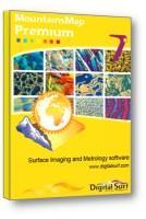
all-in-one surface imaging, analysis and metrology software superset for all types of surface imaging and measuring instrument Top of the line surface imaging, analysis and metrology software MountainsMap® Premium software is a superset of all other MountainsMap® products. It is ready to use with the widest range of surface imaging, analysis and metrology instruments. Advanced features included The most powerful solution for surface imaging, analysis and metrology, MountainsMap® Premium includes all of the advanced surface analysis features that are available in optional modules for other MountainsMap® products. The only optional modules are for highly specialized applications. All of the latest standards & methods Working in MountainsMap® Premium's smart desktop publishing environment it is easy to turn your surface data into detailed visual surface analysis reports in accordance with all of the latest standards and methods.
Request for a quoteDo you sell or make similar products?
Sign up to europages and have your products listed
Results for
Integration - Import exportNumber of results
2 ProductsCountries
Company type
Category