Belgium, Rocourt
Quadratic is a Belgian service company specializing in the management and processing of geospatial data. Our areas of expertise cover Geographic Information Systems and Earth Observation. Thanks to geodata, you can for example: » Refine your business strategies based on objective information. » Strategically and ideally position your infrastructures. » Make forecasts and plan agricultural yields...
France, CORDON
Presta-SIG is a consulting and training company specializing in geomarketing and geographic information systems. The company offers services such as: - catchment area analysis - territorial positioning study - sales route optimization Also registered as a training organization, Presta-SIG provides training on the use of GIS, primarily focusing on the Geoconcept software, for which it is an accredited trainer. Presta-SIG is located at the crossroads of France, Switzerland, and Italy and operates throughout Europe.
Belgium, Miécret
DrivenBy offers professionals the opportunity to access modern technologies for collecting, utilizing, and disseminating geographic information. Based on strong experience and a network of specialized partners, the services and products offered by DrivenBy focus on the frequent updating of information, its near real-time transmission, and its alignment with the actual needs of users in terms of quality and accuracy.
Italy, Catania
... personnel who previously worked at Lamina Messina Sistemi, which has been a leader in the sector for more than forty years. We offer our clients various software solutions for attendance tracking and management. From the simplest option aimed at replacing paper time cards, to the most comprehensive with innovative features. Our knowledge spans all operating environments (Windows, Linux, MacOS, Mainframe) to all network systems (geographic, local, point-to-point, wireless).
Italy, Milano
... Industrial environments, leveraging the experience gained over years of activity in the railway sector. Sysnet Telematica offers specific expertise in delivering solutions for the conversion and transport of data in proprietary (Legacy) systems, TCP/IP technologies for Geographic Networking, and supervision systems, with a focus on the quality of its operations (ISO 9001-2008) and customer satisfaction...
... (with checks at the end of each stage) that meets client specifications and is delivered on time. Walphot is proficient in the following areas: aerial photography, airborne LiDAR, aerial thermography, processing and interpretation of images from satellites or airborne systems, production of photogrammetric and topographic maps, inventory of trees along roadways, digital orthophotography, environmental studies...
France, Paris
...personas, user testing, artistic direction, UX & UI design, etc. - Website Creation and Redesign: Ecosystem, custom development, Gutenberg, and page builders. - Project Industrialization: Architecture, interoperability, DevOps, and Cloud. - Mastery of development-related topics: Server strategy, performance optimization, integration with information systems, etc. Do you have a digital project to deploy but face uncertainties or a limited budget? We can assist you by developing an MVP (minimum viable product) project for you in an agile manner.
Italy, Foggia
Founded in 1992 from field experience, GEOSIS srl is a company that provides technical and administrative support to businesses, public and private administrations in the following sectors: • Alternative energy systems • Study of technological network routes • Topography • Authorization processes • Geographic Information Systems • Real estate investigations • Territorial computerization...
Luxembourg, Luxembourg
...SKYLIZ Connect is a Luxembourg-based company developing its activities around new tools for Optimization, Planning, Research and Development in optimization and performance of Systems, GIS (Geographic Information Systems), Development of Spatial projects, and popularization of satellite navigation technologies (GNSS/EGNOS), as well as the Optimization of logistics flows. To meet your needs, we...
Belgium, Leuven
GIM develops innovative techniques for processing spatial data, designs groundbreaking applications for geo-information, and integrates the latest technological advancements.
Netherlands, Diemen
All real estate information at a glance, the appraiser relieved of burden. We provide complete information support throughout your appraisal process. More appraisals, less administration We have consolidated all fragmented real estate data in our central portal. This way, as an appraiser, you have all the required attachments and documents readily available, allowing you to spend less time on adm...
Spain, Malaga
... marquee rental, event furniture rental, sound system rental, professional lighting hire, staging and stage structures, design and print services, corporate video production, live video production of conferences, and live video streaming services via satellite from southern Spain. Our location on the outskirts of Malaga means we are easily on hand to serve both corporate and private events in Marbella and the broader geographic region of Andalucia, while a series of logistics solutions enable the cost-effective delivery and installation of our products throughout the Spanish peninsula.
... for creating periodic reports or HTML pages, as well as the ability to transmit system messages (threshold exceedances, text forms) via FAX, pager systems, or as text messages in radio call services. In addition to MEVIS, UMAD GmbH has developed a number of other software solutions, such as a conversion program for geographic coordinates into various reference systems or an organizer program for radio call services. The company is also engaged in the preparation of environmental information in emission registries, air quality plans, and the presentation of measurement data on the Internet.
Belgium, Louvain-la-Neuve
... formulation studies - Hydrological and hydrogeological studies - Geological and geophysical studies - Technical and operational studies - Groundwater modeling - Geographic Information Systems - Technical assistance - Institutional support and training - Water resource planning - Monitoring and evaluation - Research and management of water for mines and quarries - Quality assurance - Institutional support and training - Supervision of works and maintenance...
Belgium, Strud
OSCARS offers independent consulting around Oracle Spatial (*) to enable you to freely utilize your GIS (Geographic Information System) data. Oracle has established itself as a major player in the field of information systems. The Oracle database indeed meets all the needs of a high-level professional GIS thanks to its storage capacity, its management of very large amounts of data, and its...
Belgium, Marchin
The techniques implemented by the company include mapping, geographic information systems, spatial analysis, aerial photography, satellite remote sensing, and GPS. The areas of application are very diverse: land use planning, environmental studies, urban planning, infrastructure planning and management, demographics, health and epidemiology, tourism, forestry, surface and groundwater hydrology...
Slovenia, Maribor
The company Solve-x specializes in the development of complex systems for data collection, display integration, and consolidation of various forms of data. Rich experiences in the field of data processing enable us to offer our clients the implementation of competitive solutions and comprehensive consulting. Developing systems in different areas: - Geographic information systems - Advanced surveys - Marketing automation tools - Call centers - Human resource management - Custom CRMs and more... Platforms: - Web applications (browsers) - iOS (mobile application) - Android (mobile application)...
France, Agen
MICROTOPO is a company specialized in the fields of topography, cartography, network studies, road projects, development projects, project management, and geographic information systems.
... media management, e-commerce, and GIS applications. Our main competencies: - Development and Maintenance of Websites - Domain Registration - Search Engine Optimization (SEO) and Search Engine Marketing (SEM) Services - Application of Geographic Information Systems (GIS) - IT Consulting - Development of Web / Mobile Apps - Social Media Management - Teaching / Training...
... resources and the monitoring of agricultural, forestry, or environmental systems, as well as assist in topographic surveys, rural registration, and land use planning, among many other applications. To date, several projects have been developed in Portugal, Spain, Italy, and São Tomé and Príncipe, all related to land management, geographic information systems, and remote sensing.
Spain, Cabanillas del campo
Beritec is a company specialized in the creation of cartography for official organizations and businesses. We have extensive experience in conducting photogrammetric flights, urban and territorial mapping, photogrammetric support work, aerotriangulation, editing, geographic information systems, laser scanning, and construction surveying.
Switzerland, Zürich
Our core competencies lie in software development based on Geographic Information Systems (Esri ArcGIS Platform) and in the field of noise. Since 2004, we have been active in combating noise from road, rail, and air traffic, for which we have developed the noise management software D-noise.
Luxembourg, Capellen
With 30 years of experience in areas such as project management, environmental and forestry studies, urban planning, road and rail infrastructure, traffic and mobility studies, hydraulics, and Geographic Information Systems (GIS), LUXPLAN S.A. is more than ever a leader in its market in Luxembourg and increasingly on an international scale. The company is active in numerous fields: roads and various networks, mobility, urban planning and land development, environment, forestry studies, safety coordination, project management, water management, civil engineering, topography, and geotechnics.
Spain, Quart De Poblet
We are a company that has been dedicated to the design and creation of custom applications for over 9 years, both in the development of Geographic Information Systems (GIS) and in the development of financial applications, business management intranets, and essentially, almost any project that piques our interest. Every business has its specific information flow, and no two companies manage...
France, Labege
... Systems (QGIS) Our team of expert consultants is here to assist you in leveraging data and optimizing performance for your business. All our training sessions are regularly scheduled in inter-company formats in Paris, Lyon, and Toulouse, and upon request in six other major cities (Marseille, Bordeaux, Lille, Nantes, Nice, and Strasbourg) as well as in virtual classrooms.
Spain, Guadalajara
Digital mapping work, especially for navigation, updates, and cartography review. Geographic information systems. Digital terrain models. LIDAR data classification. Pathological analysis of structures using non-invasive methods. Laser scanning. Rental and sale of GEOMAX equipment.
Belgium, Eghezée
100% original solutions for greater stability and efficiency Services Augmented vectorization, specific image processing, or dedicated development in office applications or on the web, over thirty years of experience at your service Cartography Cartography, topography, imaging, geographic information systems, integrated into a single environment, from the workstation to mobile and through the...
Ireland, Dublin
... almost any purpose starting with simple desktop and smartphone applications to complex OLTP databases and Data Warehouse systems including PLC and HMI software development for Industry automation systems, CNC machining, Geospatial/Geographic Information Systems (GIS) and similar. Already implemented technologies in this area: Desktop and WEB application development. Database development and...
France, Villefranche De Lauragais
... achieve the required results successfully. FISOTEC is an Engineering and Software Development Consultancy whose business lines are based on the transformation, development, implementation, and evolution of Geographic Information Systems (GIS) of the Open Source type, with a special focus on inventories of entities in cities, as well as SaaS development applied to these inventories.
Popular countries for this search term

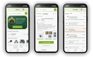
The europages app is here!

Use our improved supplier search or create inquiries on the go with the new europages app.

Download in the App Store

App StoreGoogle Play