South Korea, Seongnae-Ro 6-Gil, Gangdong-Gu, Seoul
...Description - Development of drones with unmanned remote range capable of coastal surveying, and the construction of control system capable of interworking and controlling survey information - Water Drone with Marine Remains and Sea Oil Film Treatment - Equipped with core technologies needed for maritime management, allowing for a variety of measurement and management tasks with only operation...
France, Nantes Cedex 3
...FoxBathy is an automatic bathymetric drone catamaran with double electric propulsion, which allows productivity, safety and precision in aquatic surveying. It ensures the safety of the operator, who may remain on the bank thanks to fully automated steering. FoxBathy not only helps in monitoring ports, marinas, sea areas, rivers, creeks, lakes and ponds or lagoons but also helps to identify...
United Kingdom, Bournemouth
...Baypoint Surveys Ltd is a leading Land/Geospatial Survey company based in Bournemouth, Dorset. We cover the entire UK, but most of our projects are in the south of England, including London, Hampshire, Kent, Devon, Somerset, West and East Sussex, Berkshire, Cornwall, Wiltshire, and Oxfordshire. Services are Land Surveys, Measured Building Surveys, Utility Surveys (and Ground Penetrating Radar), Setting Out, Movement Monitoring, 3D Laser Scanning, Rail Services and Drone Surveys. Call us today.
Matching products
Baypoint Surveys Ltd
Austria, Wien
...Do you want to set up a photovoltaic system on a field, or are you looking to build a house? We offer you a 3D model of your site - fast, accurate, and straightforward. "Precise planning is worth its weight in gold! However, this is often only possible if your property has been measured accurately. A drone survey is quickly available and provides the necessary data to implement your system or another project even better. With Surveyor F from EILT e.U, you receive a 3D model of your property that can be reused in many ways."...
United Kingdom, King's Lynn
Mija Survey Ltd uses the latest technology to bring clients more accurate results in less time. The services include: -Site engineering and setting out -Underground utility surveys including GPR (ground penetration radar) surveys and Drainage CCTV surveys -Topographical surveys -3D laser scanning -Site control -UAV surveys (drone surveys) The results are presented using CAD software where appropriate and expert support is always available.
United Kingdom, Ross-On-Wye
... infrastructure, such as bridges and tall buildings, and mapping land use for farming or archaeological work. We do aerial roof inspections, for small commercial buildings, hotels, schools and large warehouses. We also provide aerial wind turbine blade inspection. We provide a full pre-site assessment before we proceed, which we complete using a variety of ordinance survey maps, Google maps and UAV...
France, Paris
... and Architecture: From design to complete project digitalization, we support your authorization and implementation processes. Urban Planning and Industrial Architecture: Tailored solutions for residential, industrial, and commercial buildings. Drone Surveys: Accurate topography and energy audits via drone for effective planning. Expertise and Customization: Our experts provide technology...
United Kingdom, Exeter
United Kingdom, Liverpool
Italy, Canosa Di Puglia
... stages of the work, particular attention is given to the study of the survey and its output. At the core of the process is a true "Survey Project" aimed at achieving the requested objective with precision and speed. Passion, research, and attention to detail characterize the philosophy of our studio and guarantee added value to the deliverables, both in content and graphic presentation. Among our clients, we count public and private entities, to whom we always offer a wide range of services tailored to meet current needs.
Italy, Ospedaletti
...Surveying is knowing: 3D knowledge is the key to processing any project accurately, economically, and on time. Only a good preliminary survey conducted with the most advanced technologies reduces variations during the work and the resulting unforeseen issues. With the 3 Forms of 3D—drone aerial surveying, laser scanning, and 3D modeling—3DeFFe 'brings the object home,' precise and true to the...
Belgium, Bruxelles
Drone TechniXX brings and integrates the added value of aerial imagery through civil drones to the following sectors: industrial facility maintenance, construction, civil engineering, qualitative thermography, land and heritage management, and claims expertise for insurance companies. Drone TechniXX is a team 100% dedicated to this profession, using state-of-the-art professional equipment to offer a range of developed services and solutions that meet the expectations and requirements of its clients.
France, Avignon
As an innovative young company, GEOmatic Development was founded in 2009 by John Clérin, a geographer and expert in geomatics. It is made up of a team of specialists with multidisciplinary and related experiences in GIS and remote sensing. We offer a full range of services related to geospatial activities by mastering the entire production chain of geographic information: acquisition, integration,...
Belgium, Champion
... drone operator in Belgium and S2, S3, S4 in France, the operation of our devices is possible in all authorized configurations. We pay particular attention to compliance with active regulations in the territory where we operate risk analysis privacy protection. With 20 years of experience in aerial missions, photogrammetry, topography, and remote sensing, PIXAERO offers expertise in the acquisition and processing of aerial images for a very high-quality result.
France, Donzère
... companies in the construction sector for their periodic site inspections or the preparation of their various as-built plans or Dossiers des Ouvrages Exécutés (D.O.E). Engineering firms and architects turn to it for data acquisition for upcoming projects or inspections of structures, particularly leveraging the expertise gained in aerial photogrammetry and 3D modeling using drones. Finally, part of its activities is focused on tourism, creating interactive virtual tours from drone perspectives. Its main clients are stakeholders in the Tourism and Real Estate sectors.
Switzerland, Grabs
... recently acquired a Riegl VZ1000 laser scanner. With its high range of up to 1400m, this laser scanner allows us to better survey hard-to-reach objects. Examples include: construction pits, quarries, bridges. With our three ground penetrating radar antennas, we can offer you various application areas. New: FKL & Partner AG, in collaboration with our partner company Kreis AG, Sargans, has various drones available for diverse applications.
Terragon offers you comprehensive support in the areas of: cadastral surveying, property surveying, property boundaries, property division, building site creation. Using the latest engineering technology, we create location and height plans, as-built plans, facade views, building sections, 3D modeling and visualizations, terrain models and much more. The area survey is supported, among other things, with the help of drone technology.
Belgium, Binche
Drone-Pix.be specializes in broadcast video or HD photo capture using an autonomous remote-controlled drone for various fields: film, live HD TV, advertising, thermography, photogrammetry, multispectral, documentaries, sports, surveillance, industry, and disaster assessment. Through photogrammetric processes, we offer 3D reconstructions for topographic, architectural, or disaster-affected areas.
Specialized in aerial filming and drone rental for inspections, photos, videos, 3D modeling, and topographic surveys. Our equipment is at your disposal for use in any context and need, also offering you qualified technical consulting support from experienced instructor pilots.
Spain, Alicante
...ROV ROVTEC MARINE SERVICES SL, IMCA, Lloyds Register ROV inspection company capable of rapid deployment located in Costa Blanca, Spain. The ROV services (remote operated vehicle) performs various inspections such as ◾Asset integrity inspections ◾Pipeline inspections ◾Seabed site inspections ◾Flooded member detection ◾vessel hull inspections ◾flying drone inspections ◾ROV underwater hull/propeller cleaning ◾ultrasonic thickness measurements ◾insurance survey ◾search and recovery ◾diver support ◾cp probe ◾underwater filming ◾yacht detailing ◾dam inspection...
Video-photographic monitoring (with indoor drone) of architectural assets for restorers and cataloging. Laser cutting service on wood, plexiglass, and cardboard, for architectural models, objects, ... maximum dimensions 1200x800. Scheduled maintenance of buildings, consisting of initial check-up, annual condition assessment of buildings, technical report, survey, ... Design of residential buildings. Project Management. Safety Coordination.
Popular countries for this search term

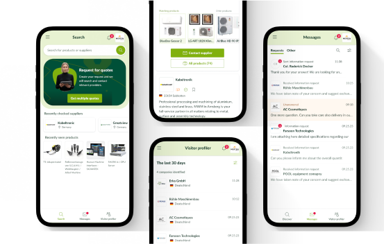
The europages app is here!

Use our improved supplier search or create inquiries on the go with the new europages app.

Download in the App Store

App StoreGoogle Play